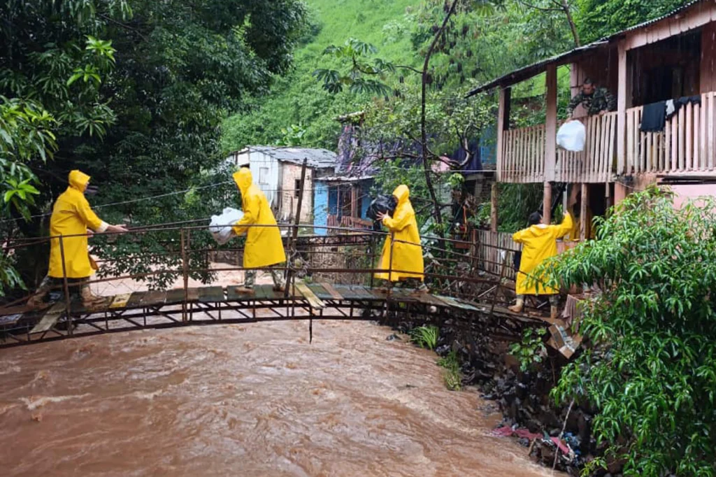
Entrance to southernmost city of Eilat blocked; authorities warn against driving or hiking in affected areas due to fear of flash floods; weather expected to worsen as night falls
Greece’s National Meteorological Service (EMY) upgraded its emergency bulletin to “Red Alert”, highest Category 3 and warned of intense weather phenomena. At the same time, the Civil Protection places in Red Code several regions including Attica. The Emergency Bulletin for Dangerous Weather Phenomena warns of heavy rainfalls and thunderstorms in several areas of the eastern […]
President has taken an axe to National Oceanic and Atmospheric Administration, stalling climate research on and response to extreme weather events
Sweeping cuts to the premier US climate agency under Donald Trump have severely hampered the country’s capacity to forecast, research and respond to extreme weather events, former government officials and scientists have warned, as the US faces a cascade of hazards fueled by a potentially historic El Niño this winter.
From the start of his second term, the president has taken aim at the National Oceanic and Atmospheric Administration (Noaa), slashing staff levels, canceling contracts and grants, and shutting down databases and research laboratories. The agency that has long been considered a global crown jewel in climate science and forecasting, has lost roughly 20% of its staff since January 2025.
A plan for a new weather-warning system that focuses on more specific locations rather than counties will not be in place this year, but some changes as part of the plan have been implemented.
After the hottest September since records in Portugal began, October too is drawing to a close with temperatures well above normal – and likely to stay that way for days
Exclusive: Coordinated airstrikes on territory held by al-Shabaab are driving the civilian population to find refuge alongside a river where rising water levels are a threat to safety. Is it a deliberate military strategy?
The water was rising rapidly. It had already reached Cayni Ali’s waist. Her home, five metres from the flooded River Juba in southern Somalia, never stood a chance. There was nowhere to go. Ali’s city of Jilib was under attack. Repeated airstrikes, said the mother of six, were pinning its population beside the rising river.
“The drones come all the time,” said the 27-year-old. “We hear them constantly. They kill animals, civilians. The town is big but destruction is everywhere.”
Greece’s National Meteorological Service (EMY) issued an emergency bulletin warning of a weather deterioration with heavy rainfalls and thunderstorms, locally hail and strong northerly winds. The bad weather front is forecast to begin in the early hours of Monday, October 26, and continue at least through Tuesday, October 27, 2026, while gradual improvement is expected as […]
LAHORE – The Pakistan Meteorological Department has forecast a powerful spell of rain entering Punjab from October 28.
A new western weather system is expected to bring rain, accompanied by strong winds and thunder, across the province, leading to a significant drop in temperature.
The rain spell will bring a change in the weather, and the intensity of the cold is likely to increase in the province.
LAHORE – Rainfall and hailstorms lashed several parts of Lahore on Saturday, bringing cool weather in metropolis.
Several localities gets showers along with hailstones, while Meteorological Department has forecast further rain and thunderstorms in the city over the next 24 hours. Rain and hail were reported in Gajjumata, Nishtar, Chungi, Walton and Harbanspura. Gulberg, DHA, Model Town and areas along Raiwind Road also experienced similar weather conditions, with rainfall and hailstones reported across different neighbourhoods.
Lahore’s temperature was recorded at 23°C. According to the Meteorological Department’s accompanying forecast, the minimum temperature is expected to reach 17°C, while the maximum could rise to 29°C.
PMD predicted another spell of rain accompanied by thunderstorms across Lahore during the coming 24 hours. Some areas may also experience hailstorms, potentially bringing further changes in local weather conditions.
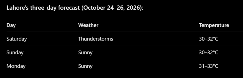
According to the supplied three-day forecast, Lahore is expected to experience thunderstorms on Saturday, October 24, followed by sunny weather on Sunday and Monday.
Despite the recent rainfall and the possibility of additional showers, the three-day outlook indicates a return to sunny conditions on Sunday and Monday.
Continental air is currently prevailing over most parts of the country, while a shallow westerly trough is passing over Kashmir and adjoining areas. These atmospheric conditions form part of the prevailing weather pattern across the region. Mostly dry weather is expected to continue across the majority of the country on Sunday. Northern areas are likely to experience cold conditions, particularly during the morning and nighttime hours.
During the preceding 24 hours, most parts of Pakistan experienced dry weather, while colder conditions prevailed in the northern areas during the morning and night. However, isolated locations in upper Khyber Pakhtunkhwa, the Potohar region and northeastern Punjab received rainfall accompanied by winds and thunderstorms.
Capital Islamabad, and other cities also received rainfall at several locations over the weekend.
Hurricane Vance is expected to steadily intensify in the next 24 hours and turn into a major hurricane by Friday night, according to projections from the National Hurricane Center. “Swells generated by Vance are expected to begin affecting portions of the coast of southern and southwestern Mexico this weekend and continue into next week,” the…
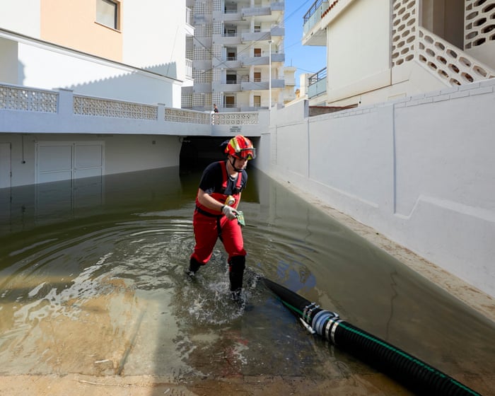
Storm Adam brings torrential rain to Valencia, Alicante and Balearic Islands, as Storm Austen strikes England and Wales
Storm Adam brought torrential rain to eastern Spain earlier this week. In Pego, Alicante, 632mm fell in 36 hours, with 430mm of this falling in just six hours, while the Valencian town of Oliva received 600mm in 24 hours.
The severe flooding led 145 municipalities across Valencia and Alicante to impose a temporary lockdown on about 850,000 people on Monday. At least five people have died, 500 have been rescued and 2,100 evacuated.
People succumbed to heat at highest rates in Malta, Italy and Hungary, with health issues, loneliness and poverty exacerbating toll
Heat killed a record 50,000 people in European cities this summer, new research suggests, with scientists blaming climate breakdown for two in every three of the deaths.
Morgues and funeral homes filled with bodies from June to August as the heat added by planet-baking pollution cut short an extra 32,000 lives in urban areas, the researchers found. Hot days pushed vulnerable bodies into overdrive and warm nights prevented them from recovering.
Severe flooding caused by heavy rainfall and the rising Parana River has forced the evacuation of some 4,200 families in eastern Paraguay, with local authorities monitoring vulnerable areas to move residents into temporary shelters.
More than 1,000 severely damaged homes are concentrated in the municipality of Ciudad del Este, where the rising waters have swallowed entire parcels of land. Remansito neighborhood was hit hardest. Around 35 families who work in recycling had to abandon houses submerged under the floodwater.
The emergency extends beyond that city. In the department of Ñeembucú, severe flooding has been reported in the towns of Ayolas and Cerrito. Local authorities and rescue teams continue to watch the most exposed areas as they coordinate the transfer of affected residents to temporary shelters.
The scale of the crisis has grown quickly. Just days earlier, official figures put the number of affected households at 3,000, a count that has now risen above 4,200 as the river keeps climbing.
Residents along the riverbank say the situation worsens considerably each time the gates of the Itaipu Binacional hydroelectric dam open. They argue that releasing the reservoir’s excess water has an immediate and direct impact on homes built along the coastal strip.
Representatives of the hydroelectric facility defended the maneuver. The gate openings, they said, respond strictly to technical safety protocols established for operational contingencies. The dam’s administration rejected the claim that these operations are the main cause of the river overflowing in the region.
The dispute places technical necessity against lived experience. For the communities watching water pour into their streets, the relationship between the releases and the flooding feels direct. For the dam operators, the gates are simply doing what they were designed to do under extreme conditions.
The national weather agency has offered little relief. Projections from the Directorate of Meteorology and Hydrology warn that rain will continue falling through the weekend across the country’s eastern zone. The agency urged the public and protection agencies to maintain precautionary measures amid the risk of new landslides.
#Paraguay | Families in La Rivera have been affected by flooding along the Paraná River, with rising water levels impacting homes and surrounding communities. Footage captures the extent of the flooding and the challenges faced by residents as they deal with its consequences.… pic.twitter.com/7GKTOoXEnB
Solidarity has also moved through the affected areas. Neighbors in working-class sectors have organized to supply community kitchens and distribute donations of basic goods. That support network has become essential for families who left their homes with little more than what they could carry.
The flooding follows a pattern familiar to the region. The Paraná River, one of South America’s largest waterways, regularly swells after sustained rains, but the current emergency has outpaced local capacity to respond.
With the forecast showing no break in the weather, the number of displaced families could continue to rise. Shelters are filling, and the most vulnerable households, including those who earn their living from recycling along the riverbank, face an uncertain wait before the waters recede enough to return.
The UN World Meteorological Organization warned Wednesday that the current El Niño episode could push Pacific sea surface temperatures to 3.8 degrees Celsius above the average between November 2026 and January 2027, levels its top official called unprecedented in four decades of monitoring.
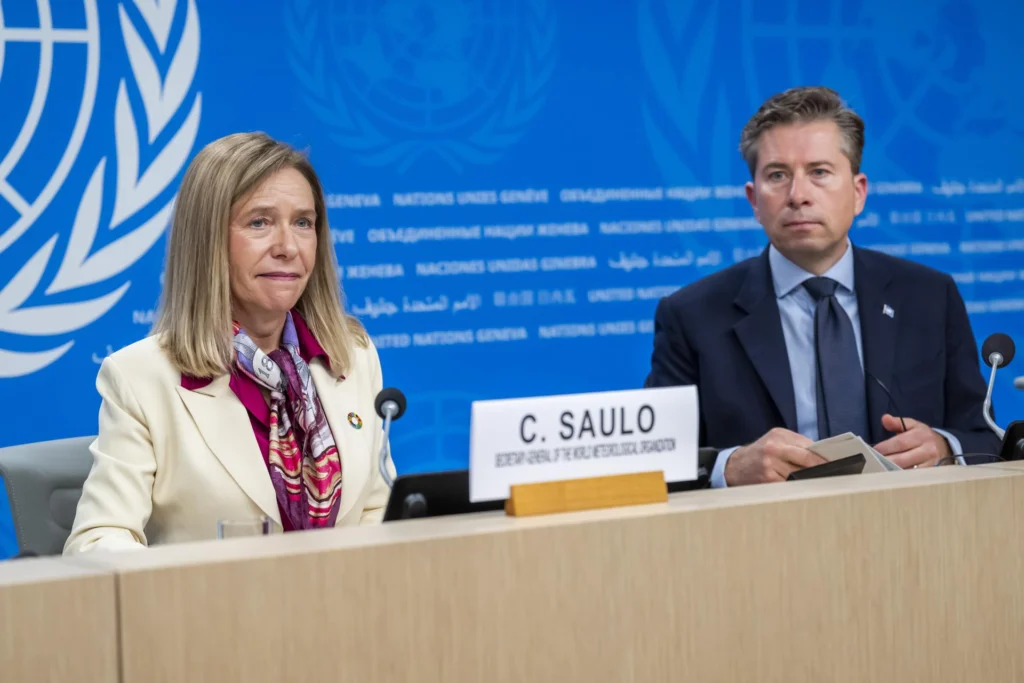
The alert came during a joint press conference in which the World Meteorological Organization (WMO) Secretary-General Celeste Saulo acknowledged that the phenomenon now sits “literally outside the scales of monitoring that we have used over the past four decades.”
Her assessment placed the coming months among the most severe climate events recorded since such tracking began.
Saulo and UN humanitarian coordinator Tom Fletcher issued an urgent call for the international community to prepare in advance for the consequences they expect.
Fletcher put the human cost in stark terms. The phenomenon “will shake Latin America, eastern and southern Africa, Asia and the Pacific with extreme heat, droughts and floods,” he warned, and could push food insecurity to affect as many as 50 million people worldwide.
The warning singled out regions already struggling with fragile agricultural systems and limited infrastructure, where a single failed harvest can tip entire communities into crisis.
El Niño is set to hit fragile communities hard.@UNOCHA and @WMO are sounding the alarm, appealing for immediate assistance to support communities already affected by what has been described as the strongest El Niño on record. https://t.co/LDrygGkPPwpic.twitter.com/H1XcVA3AR7
The temperature projection of 3.8 degrees above the long-term average would place this El Niño beyond the upper bands of the monitoring framework built over forty years. Saulo noted that extreme weather events are already being recorded and will tend to multiply as the phenomenon gains intensity. She stressed, however, that the crisis “does not have to inevitably trigger a humanitarian disaster,” a message both officials repeated throughout their appearance.
To front-load the response, Fletcher announced the allocation of 50 million dollars from the UN emergency fund. The money will assist 11 of the most vulnerable countries as a priority, including Chad, El Salvador, Ethiopia, Somalia and South Sudan. The list reflects the broad geographic reach of the expected impacts, spanning the Horn of Africa, the Sahel and Central America.
Both representatives insisted that a window of opportunity remains open. Extreme conditions “do not have to translate into humanitarian emergencies or fatalities” if precautions are taken in time, they argued, framing preparedness as the difference between a difficult season and a catastrophic one.
A Narrow Action Window
Saulo and Fletcher directed their appeal beyond governments. WMO and the humanitarian office urged development banks and international financial institutions to release funds in a coordinated manner before the worst damage occurs. The underlying premise is simple, El Niño cannot be stopped, but its worst human impacts can be mitigated and prevented.
Latin America appears prominently in the forecast. Central America has already been placed on maximum alert over drought conditions linked to the so-called Super El Niño, and the new warning extends that concern across the region. Africa faces the mirror problem in several zones, with eastern and southern areas bracing for a combination of heat, drought and flood depending on local geography.
WMO’s warnings marks a departure from the cautious phrasing typical of international agencies. Describing the phenomenon as off the scale is not a rhetorical flourish but a technical judgment, one intended to shake loose the funding and coordination that slow-moving bureaucracies often withhold until emergencies are already visible. For Saulo and Fletcher, the next three months represent the period when that response must be assembled, not the period when it can still be debated.

 Login